MUSA · 30 DAY MAP CHALLENGE · DAY 02: LINES
The Nile, Connected
One basin, many tributaries.
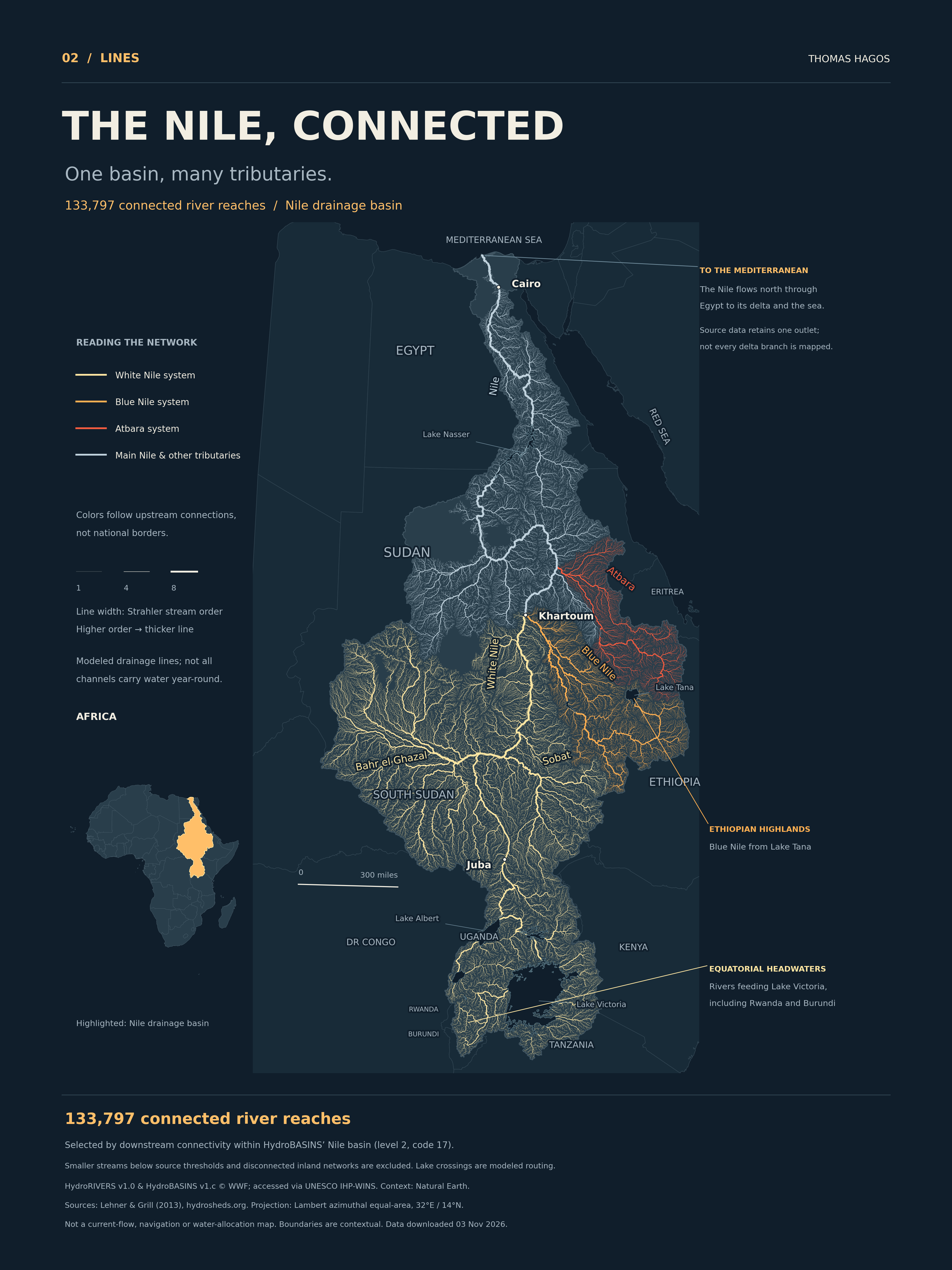
I followed the Nile upstream: through Sudan, into the Ethiopian highlands and the equatorial lake catchments. These branching lines show how a river network comes together across borders.
The Africa locator places the basin on the continent. Headwaters feeding Lake Victoria and the Blue Nile from Lake Tana come together in a network that flows north through Sudan and Egypt to the Mediterranean.
WHAT THE LINES SHOW
Follow the connections.
Each line is a river reach in HydroRIVERS. I used its downstream links to retain the connected Nile network, then traced upstream from the White Nile, Blue Nile and Atbara confluences to assign the colors.
Thicker lines have a higher Strahler stream order. When two streams of the same order meet, the order increases. Width describes the branching hierarchy; it does not represent current water volume.
WHERE THE MAP STOPS
A basin, with limits.
The outline comes from HydroBASINS’ Nile basin, code 17. The network excludes smaller streams below the source thresholds and other outlet networks inside that broader boundary. Some drainage lines are dry or intermittent.
The data routes the river to one outlet at the Mediterranean. It does not capture every delta branch or canal. Lake crossings are modeled routing, with generalized lake outlines drawn above them. No missing channels were invented.
SOURCES & REPRODUCTION
Made from documented hydrography.
HydroRIVERS and HydroBASINS were developed by WWF and McGill University; the archives used here are hosted by UNESCO IHP-WINS. The boundary and line data share the HydroSHEDS framework. Lake shapes and country context come from Natural Earth. The Nile Basin Initiative’s reference maps and station directory helped check the river-system names and geographic relationships.
The reproducible Python workflow checks downstream IDs, cycles, source-basin membership and endpoint continuity. All retained downstream endpoints match their next reach. Projection: Lambert azimuthal equal-area centered on 32°E, 14°N.