1921

Two states.
One agency.

The power to join two shores.

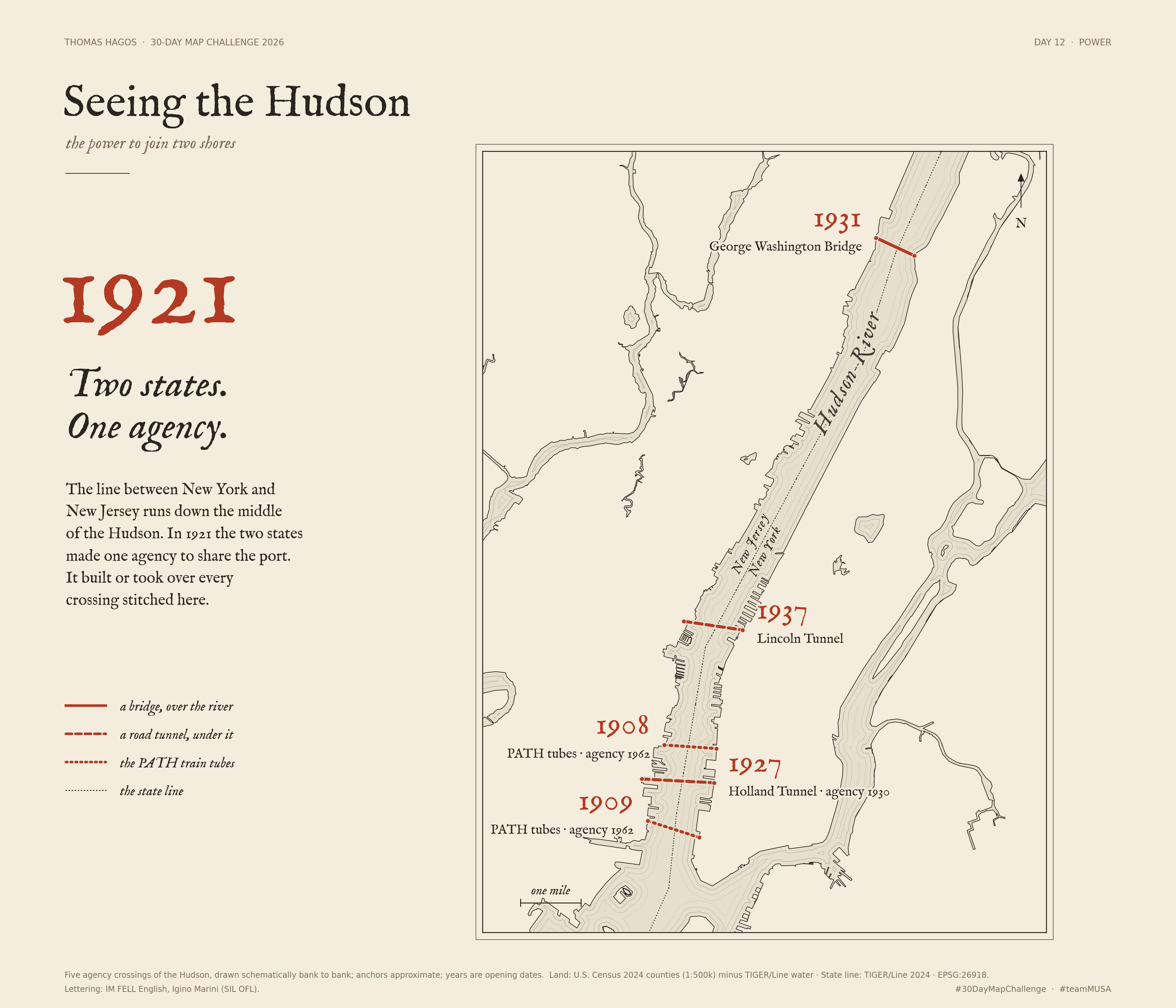
The line between New York and New Jersey runs down the middle of the Hudson. In 1921 the two states put their shared port under a single agency. The Compact turned cooperation into an institution with the power to build. It built or took over every crossing stitched on this map.

A companion to Day 5, Seeing the Hudson: the same river, seen as a border instead of a view.

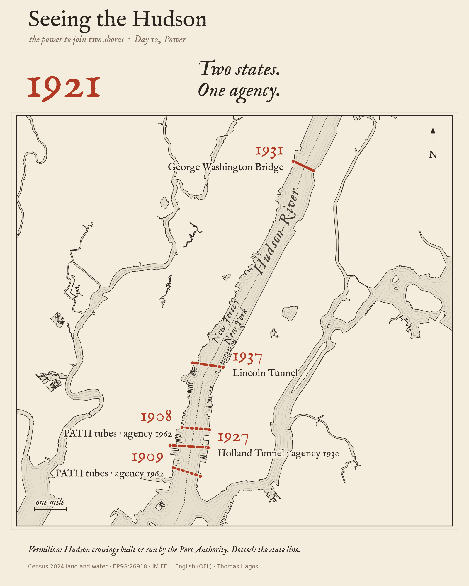
Ink-on-paper map of the Hudson between Manhattan and New Jersey. A dotted state line runs down the middle of the river; five vermilion crossings stitch across it, labelled 1908 and 1909 (PATH tubes), 1927 (Holland Tunnel), 1931 (George Washington Bridge) and 1937 (Lincoln Tunnel).
One idea: the state line runs down the middle of the river, and the agency stitched across it. Solid = bridge, over the river; dashes = road tunnel, under it; dots = PATH train tubes. Crossings are schematic bank-to-bank links and anchors are approximate.
Download the mapPhone editionCrossings CSVResearch & source checksCode & sources

What the power built

The agency’s works changed the scale of the region. The George Washington Bridge opened in 1931; Ammann’s main span was nearly twice the previous record. The agency leased LaGuardia and Idlewild/JFK in 1947, then Newark in 1948. Bridge history · Airport leases · Newark lease.

In 1956, Malcom McLean’s Ideal X sailed from Port Newark. Container shipping helped shift the port’s center of gravity toward New Jersey. The agency opened Elizabeth’s terminal in 1962—the year it also took over the H&M railroad as PATH. The original World Trade Center followed in 1973. Shipping · Elizabeth · PATH · WTC dedication.

That regional way of thinking also runs through the 1929 Regional Plan and Jean Gottmann’s Megalopolis (1961), the Boston–Washington urban chain with New York at its center. The Port Authority helped connect its New York–New Jersey core; it is one part of that larger story.

Historical frame: Jameson W. Doig, Empire on the Hudson (2001). The map uses the stitch rather than a circle: the Compact defines the Port District through boundary points and connecting lines, not a literal 25-mile radius.

Dates, portfolio and how to read the map

Selected milestones

  1. 1921New York and New Jersey create one port authority. Source
  2. 1931George Washington Bridge opens. Source
  3. 1947–48Airport leases cross the state line. Source · Further source
  4. 1956McLean’s Ideal X sails from Port Newark. Source
  5. 1962H&M becomes PATH; Elizabeth terminal opens. Source · Further source
  6. 1973Original World Trade Center dedicated. Source

The Holland Tunnel opened in 1927 and came under agency control in 1930. The Lincoln Tunnel opened in 1937, with more tubes in 1945 and 1957. H&M’s river tubes predate PATH: 1908 and 1909. Holland · Lincoln · H&M/PATH.

FY2026 portfolio

4bridges
2tunnels
1PATH rail system
2bus terminals
5airports
4marine terminals
1World Trade Center campus

Summary categories from the FY2026 budget, p. 4, not counts of marks on this map. The agency has other responsibilities too.

The airports, docks and WTC are part of the agency’s story told above but are left off the map to keep it on the river. Only the five Hudson crossings are mapped. Land and water: U.S. Census 2024 (1:500k counties minus TIGER/Line water); state line: TIGER/Line 2024. Anchors are approximate portal or terminal areas. Projection: NAD83 / UTM 18N; grid north; scale in miles. No surveyed alignment or legal jurisdiction boundary is drawn.

IM FELL English roman and italic, Igino Marini (SIL OFL 1.1), supplies the lettering; DejaVu Sans carries the small print on the map.